UAV UGV Roadmap Geomatics & Remote Sensing Infrastructure & Construction Defence & Security Work with us
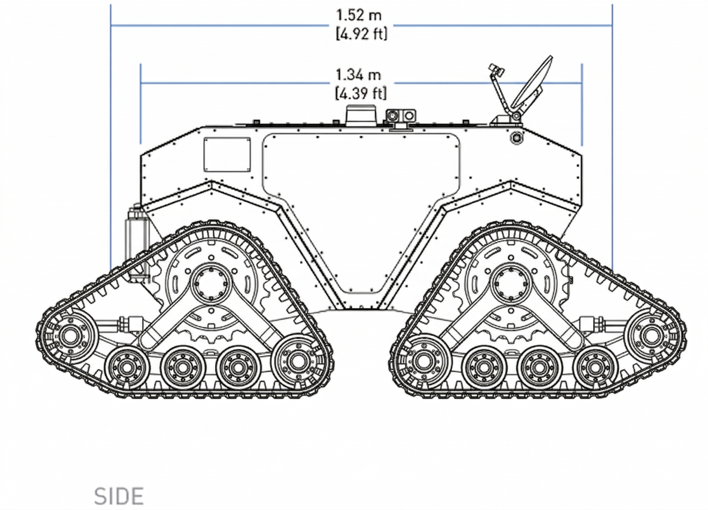
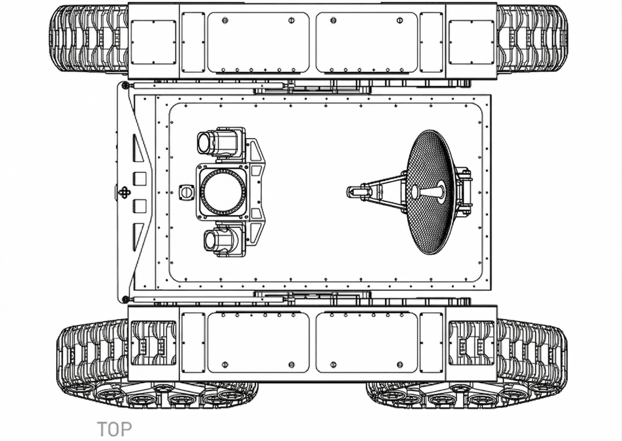
Fleet / Ground Survey Platform

Pathfinder. Autonomous tracked ground platform.

1,300 lbs all-terrain tracked chassis. 360 Velodyne LiDAR. Autonomous SLAM + RTK navigation. Operates where aerial platforms can't reach, in coordination with Trinity.

Platform Specifications

01
1,300 lbs. All-terrain tracked chassis.
1.52 m length, 1.34 m height. Tracked platform handles mud, rock, slopes, and standing water. Operates in terrain that stops wheeled vehicles and makes foot-based survey impractical.
02
Autonomous SLAM + RTK navigation.
AI-driven path planning and obstacle avoidance through unstructured terrain. Fused LiDAR and GNSS positioning. Deploys, operates, and returns without human intervention.
+
03
Mesh radio + GNSS communications.
Self-forming mesh network maintains connectivity across terrain where line-of-sight is broken. GNSS antenna for precise geolocation of all collected data. Operates in areas with no existing comms infrastructure.
+

Ground-Level Sensing

04
360 Velodyne spinning LiDAR.
Continuous 360-degree point cloud capture at ground level. Captures infrastructure detail under canopy, inside structures, and along surfaces where airborne data falls short.
+
05
Ground truth verification.
Close-range sensing fills the gaps that aerial surveys miss. Underside of bridges, interior of tunnels, base of structures, vegetation-obscured assets. Validates and completes airborne datasets.
+
06
Hazardous site operations.
Active construction zones, unstable terrain, steep grades, confined spaces, and areas with restricted access. Continuous operation in conditions that delay or prevent manual survey.
+

Air-Ground Coordination

07
Coordinated with Trinity.
Ground and air platforms share positioning, sensor data, and project plans in real-time. Combined datasets eliminate gaps between aerial coverage and ground-level detail. One operator manages both platforms from a single interface.
+
08
Persistent autonomous operations.
Extended endurance for continuous day-night cycles without downtime. When aerial platforms are grounded by weather or darkness, Pathfinder maintains the project on the ground.
+
09
Single operator, full coverage.
Unified command interface controls both Pathfinder and Trinity through a common operational picture. Plan, adjust, and coordinate air and ground survey platforms from a unified interface without scaling headcount.
+

Ground truth, autonomously delivered.

Work with us